Water/Wastewater

G&AI brings extensive expertise to water and wastewater projects, actively contributing to numerous projects since 1993. G&AI has experience with governmental water/wastewater clients, specifically the North Texas Municipal Water District, the Trinity River Authority, Tarrant Regional Water District, Dallas Water Utilities, Colorado River Municipal Water District, and the San Jacinto River Authority. G&AI’s project portfolio includes, but is not limited to, pump stations, relief interceptors, raw water pipelines, force mains, lift stations, transmission lines, drainage improvements, water and sanitary sewer rehabilitation, and meter stations. G&AI provides comprehensive services to complete these projects, including Topographic Surveys, Right of Way and Easement Acquisition Surveys, Boundary Surveys, Horizontal and vertical control surveys, Mobile LiDAR, Aerial Photography, Aerial LiDAR, and GIS.

Ward County Water Supply Expansion

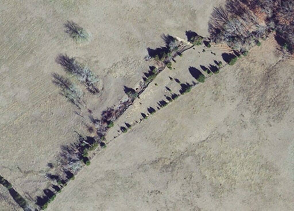
G&AI provided aerial photography and photogrammetry services for the Ward County Water Supply Expansion. G&AI obtained new, color aerial photography for approximately 16,724 acres in Ward County and a pipeline corridor approximately 45 linear miles (500’ width) in Ward and Ector Counties at an altitude of approximately 2,000’ AMT. Airborne GPS data were collected simultaneously with the acquisition of the aerial photography. Photogrammetric control surveys conformed to or exceeded the US Army Corps of Engineers Photogrammetric Control Standards for ground control. The Fully-automated Aerial Triangulation (FAAT) process was performed, and Digital Terrain Model (DTM) data were collected in a manner that accurately depicted the terrain. Contours at 1’ intervals were developed from the DTM data and delivered in AutoCAD format.

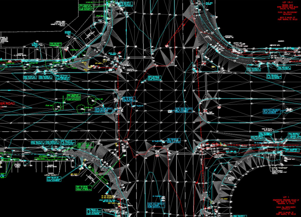
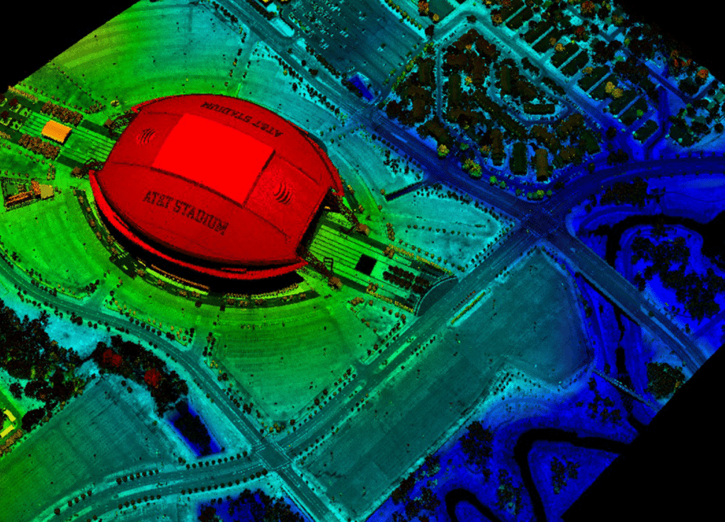
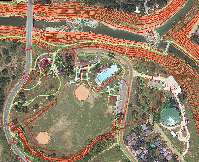
Topographic & Design Surveys
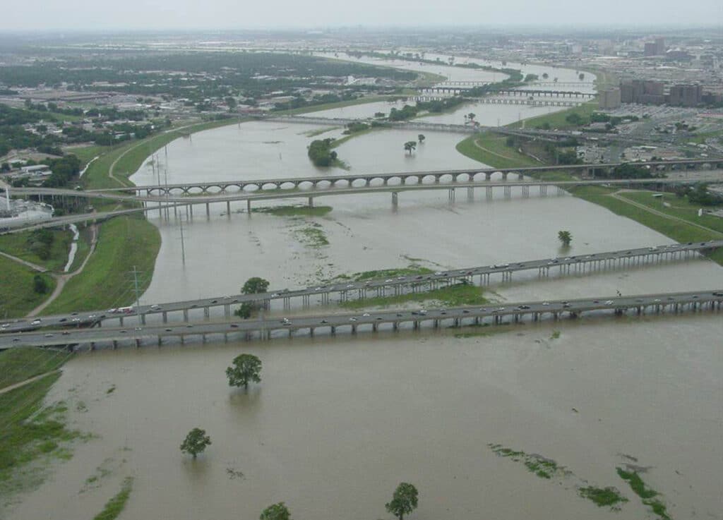
G&AI has performed thousands of engineering design surveys, including municipal projects, airports, street rehabilitation, proposed roadway, sanitary sewer rehabilitation, water rehabilitation, water and sewer transmission lines, gas pipelines, electrical transmission lines, and development projects. G&AI also utilizes the latest in surveying technology, such as GPS and robotic total stations, to ensure the accuracy of the survey data. G&AI prides itself on its training program for engineering design surveying and the ability of its field personnel to accurately depict the necessary information for these surveys in the form of field notes and sketches.

NCTCOG

G&AI performed survey services for the 2017 NCTCOG orthoimagery and LiDAR project. The project required 116 ortho imagery PID points to support ASPRS Class I accuracy orthoimagery within the 13,866 square miles orthoimagery project area, 56 LiDAR control points, and 33 LiDAR checkpoints to support ASPRS Class I accuracy LiDAR data within the 1340 square mile LiDAR project area. Total points surveyed were 205 and all survey met the project accuracy specifications. The ground control accuracy satisfied a Local Network accuracy of 5-centimeters at the 95% confidence level. Additionally, in 2015 G&AI provided ground control for the NCTCOG 0.5m aerial LiDAR project for TRWD, totaling 618 square miles.

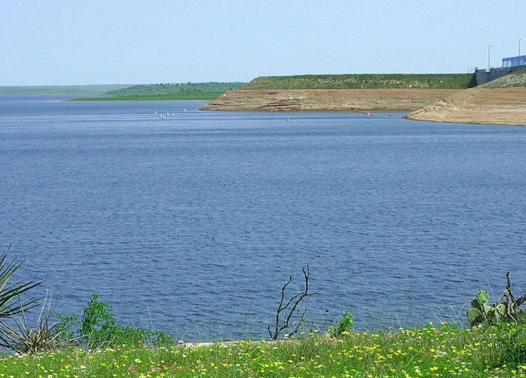
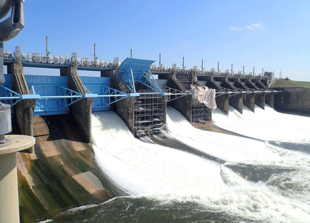
Lake Livingston Dam Spillway

G&AI performed terrestrial scanning services for Gate 4 of the Livingston Dam. Surveyors set 3 control points on the Gate 4 structure and utilized terrestrial scanning technology to produce accurate measurements for the following gate elements: width of opening; width of gate skin plate/edge of metal; distance from centerline of gate to wall; and distance from centerline of gate to edge of gate. Terrestrial scanning produced a point cloud point density containing approximately 10,000 points per square meter and held a vertical RMSE of +/- 0.04’ accuracy on hard surfaces. Once the LiDAR was registered and processed, G&AI extracted 3D measurements of each requested element.  Deliverables included 3-D CAD measurements in both AutoCAD and Excel formats, drawings, an ASCII point file, and a LandXML file.  Figure 1 is a project image.

Right of Way and Easement Acquisition Surveys

G&AI understands right-of-way and easement acquisition surveys, and over the past 30 years, G&AI has produced thousands of parcel maps and easement documents for right-of-way, water, wastewater, gas pipeline, transmission line, and telecommunication projects. All parcel map easements and boundary surveys are computed and produced by a RPLS. Each document is cross-checked by another RPLS, with a mathematical closure sheet produced for both the plat and field notes that comprise the exhibit.

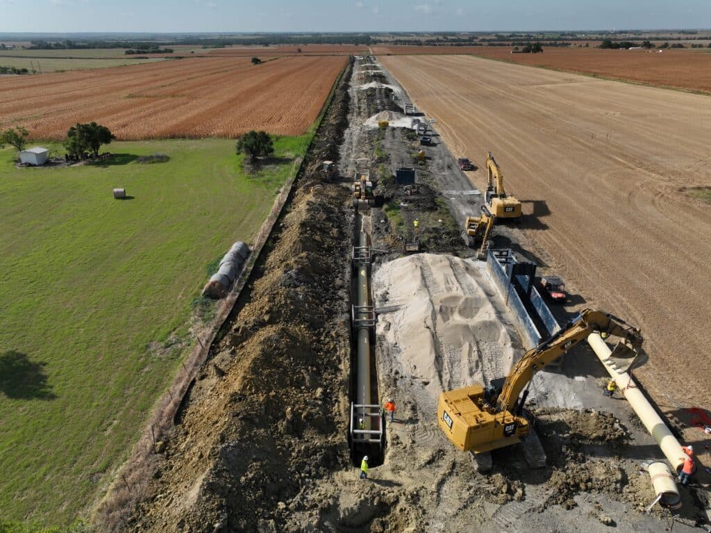
Texoma to Wylie Waterline Extension 48” – 105”

G&AI was responsible for several surveying task which included boundary, topographic, and survey control for the Texoma to Wylie Waterline Extension project. This project consisted of a water transmission line being approximately 45 miles in length and a water treatment plant. G&AI established five main GPS static control points across the waterline project and it was placed to be used on future NTMWD projects. The main control was tied into existing GPS static control points form a previous NTMWD reservoir project completed by G&AI several years prior. G&AI set horizontal and vertical control points for construction every 1500’ along the route. All control established was based on the Texas State Plane Coordinate System NAD 83, North Central Zone, with NAVD 88 elevations. G&AI performed boundary surveys for approximately 32 miles of the waterline which included adjoining parcels to the subject properties. G&AI also prepared a right-of-way map and legal descriptions with exhibits for easement acquisition across 200 parcels of land

San Antonio River Authority Mission Reach

G&AI provided as-built aerial mapping services. along approximately nine miles of the San Antonio River referred to as the “Mission Reach”.  The area extended from downtown San Antonio to a point approximately one-half mile south of IH-410 on the south side of the City. GA&I acquired both color and color infrared aerial photography of the project area using a Zeiss/Intergraph DMC II digital sensor.  This consisted of 170 overlapping exposures taken from a flight altitude of 2100’ AMT and included the acquisition of both airborne GPS and IMU data. Prior to taking the aerial photography, G&AI survey crews established targets at 54 strategic locations throughout the project area.  The crews also acquired horizontal and vertical GPS ground control at each of the 54 points, all of which were visible on the imagery.  G&AI then performed an analytical aerial triangulation adjustment of the targeted ground control.

Construction Staking

G&AI has been involved in numerous construction projects across the State of Texas. These projects range from a simple temporary driveway for a construction entrance to a complex and tight layout of an automated robotics system on the assembly line of the F-35 Joint Strike Fighter at Lockheed Martin, and a fast-track design-build 60 mile 48” water transmission line in Midland, Texas. G&AI has worked in the utility, civil/heavy civil, commercial, and industrial construction markets, and has also participated in several design build projects within these various markets. G&AI has represented the owners of several construction projects by providing QA/QC second checks on the layout of others. The working knowledge of the construction project and the relationships built with clients, from the owner to the superintendent, is what sets G&AI apart in this area of surveying.

Our team is happy to answer your questions. Contact us and we’ll be in touch as soon as possible.

Scroll to Top