Commercial
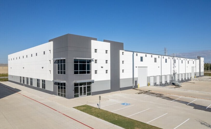
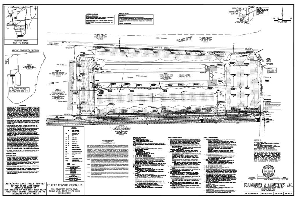
G&AI has been actively involved in several developmental projects for TGS Cedar Port Industrial Park in Baytown, TX, which spans more than 15,000 acres. The scope of work encompasses a variety of tasks, including conducting ALTA/NSPS Land Title Surveys and topographic surveys on large tracts, roads, ponds, and rail systems. Additionally, G&AI plays a vital role in construction projects, helping to plan and lay out essential utilities and infrastructure. Responsibilities include creating survey exhibits and drafting legal descriptions for proposed utility installations, such as sanitary sewer systems, water lines, and storm sewers. G&AI offers specialized surveying services to numerous civil engineering clients, focusing on pre-construction design surveys. G&AI’s expertise covers a range of projects, including office buildings, industrial sites, expansive warehouse projects, and intermodal transportation facilities. This diverse portfolio highlights G&AI’s capability to handle complex surveying needs across various construction projects.
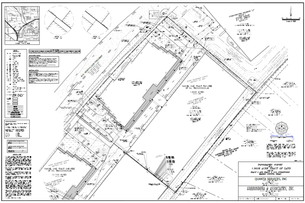
A 2.11 ACRES OF LAND BEING TRACTS 2 & 3 OUT OF 610-SUBDIVISION
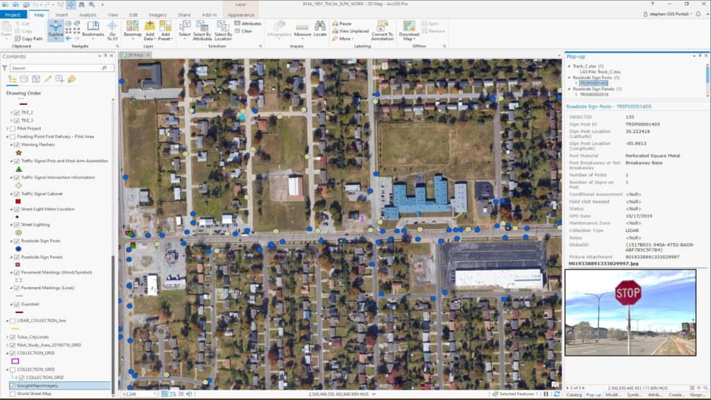
Tulsa Asset Inventory
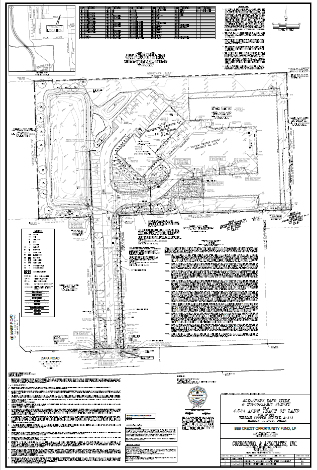
4.5393 ACRE RESTRICTED RESERVE “A”, AMSTAR
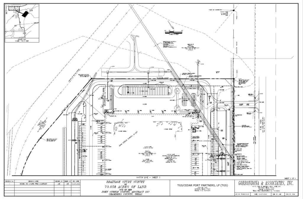
CEDAR PORT TRACT 2 – 1.2M SF WAREHOUSE SITE (73.058 ACRES)
Intersection Improvements at S. Hulen Street at Oakmont Boulevard
CEDAR PORT CAL CARTAGE (11.568 Acres)
14R 32K Taxiway Improvement
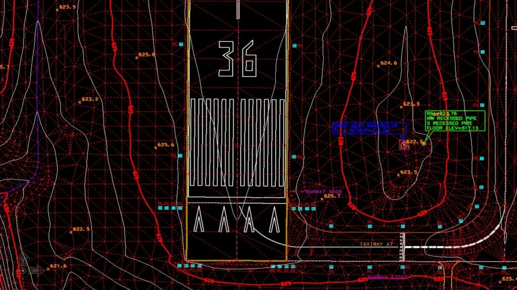
14R 32K Taxiway Improvement
Our team is happy to answer your questions. Contact us and we’ll be in touch as soon as possible.