About Us
Firm History
Who We Are
Gorrondona & Associates, Inc. (G&AI) is a Texas Corporation with rich experience spanning over 33 years in successfully managing complex projects across the state. As leaders in the Professional Land Survey field, we have established a strong reputation for innovation and excellence. Our team’s continuity and diverse experience working with established workflows are integral to our consistent success in survey and mapping projects. We take pride in delivering an unmatched efficiency level across a comprehensive spectrum of services.
The founder, Brad Gorrondona, RPLS, holds G&AI’s sole ownership. Established in 1990, the company maintains a staff of nearly 80 people, including 11 registered professional land surveyors, two licensed professional engineers, two certified photogrammetrists, a certified mapping scientist – LiDAR, a geographic information system professional (GISP), and 20 survey field crews.
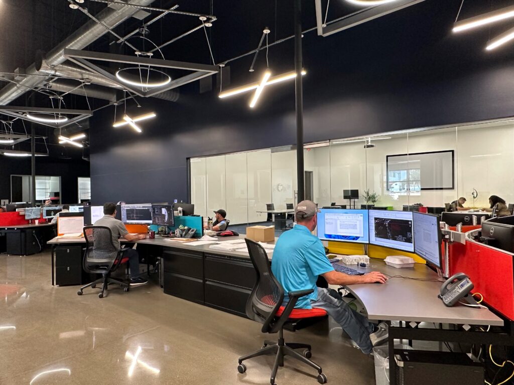
G&AI’s Culture
At G&AI, we have earned a stellar reputation for our commitment to quality, reliability, and client satisfaction. We attribute our success to the combination of our experienced staff, implementation of cutting-edge technology, and the ability to consistently deliver projects on time and within budget. This has become the cornerstone of our company culture. Clients trust us for our comprehensive professional land surveying services, including Mobile LiDAR, aerial mapping (photogrammetry/LiDAR), unmanned aerial system (UAS) mapping, terrestrial scanning, and geographic information systems (GIS). Our meticulous attention to detail, efficient workflows, and utilization of state-of-the-art tools and techniques ensure accurate and reliable results that meet the highest industry standards. With G&AI, you partner with a team that is dedicated to exceeding expectations. Our reputation speaks for itself, and we are committed to continuing our legacy of excellence in every project we undertake.
leadership Team
Meet the People


Brad Gorrondona, RPLS
- Founding principal of G&AI
- Registered Professional Land Surveyor in Texas since 1988 (License No. 4684), boasts an impressive 44-year career
- Associate Degree in Surveying Technology from Tarrant County College
- Resided in the Fort Worth area since 1983
- Responsible for the firm's overall management and directs its business development and quality control efforts. Extensive experience in surveying municipal infrastructure, commercial development, airport development, large diameter water and sewer pipeline projects, electrical transmission expansion and rebuilds, TxDOT on-system and off-system projects, commercial construction projects, and various topographic and boundary surveys across Texas
Active member of:
- Texas Society of Professional Surveyors (TSPS)
- Women’s Transportation Seminar Greater Dallas/Fort Worth (WTS)
- The Real Estate Council of Greater Fort Worth (REC)
- Fort Worth Hispanic Chamber (FWHC), served on the Board of Directors for 13 years and Chairman of the Board for two years
TxDOT PreCertified:
- 15.1.1 Right of Way Surveys
- 15.2.1 Design Survey
- 15.2.2 Construction Survey
- 15.3.5 Horizontal and Vertical Control


Truett Wilson, RPLS
- Registered Professional Land Surveyor licensed in Texas since 1995 (License No. 5146), boasts an impressive 38-year career with 29 dedicated years at G&AI
- Associate Degree in Surveying from Tarrant County College
- Responsible for coordinating all G&AI offices, supervising project integration and coordination between the offices. He assists with homogenizing project management and company development. Mr. Wilson oversees a dedicated team, managing resources and ensuring project success. His responsibilities include scheduling, resource allocation, and involvement in contract negotiation, client management, and business development. Extensive experience in municipal infrastructure, commercial development, airport development surveys, large diameter water and sewer pipeline projects, electrical transmission expansion and rebuilds, TxDOT on-system and off-system projects, commercial construction projects, and various topographic and boundary surveys
Active member of:
- Texas Society of Professional Surveyors (TSPS), past president of TSPS Chapter 2
- Women’s Transportation Seminar Greater Dallas/Fort Worth (WTS)
TxDOT PreCertified:
- 15.1.1 Right of Way Surveys
- 15.2.1 Design Survey
- 15.2.2 Construction Survey
- 15.3.3 Terrestrial LiDAR
- 15.3.4 Mobile LiDAR
- 15.3.5 Horizontal and Vertical Control


Scott Dunham, CP, CMS LiDAR
- Over eight years of experience with G&AI serving as the Marketing and Geospatial Director
- 26 years of geospatial experience managing large-scale aerial mapping and Mobile LiDAR transportation infrastructure projects across the country
- B.A. in Geography from the University of Texas at Austin in 1999
- ASPRS Certified Photogrammetrist (No. R1400)
- ASPRS Certified Mapping Scientist-LiDAR (No. L030)
- Has overseen over 100 TxDOT and municipal aerial mapping and mobile LiDAR design-grade projects during his tenure at G&AI
- Currently involved with TxDOT’s Digital Delivery Program, Mr. Dunham is a Geospatial subject matter expert, assisting in the development of mobile LiDAR, manned airborne LiDAR, and Unmanned Aircraft Systems (UAS) control specifications for the State
- Actively engaged in researching new innovative Geospatial technologies and processes to enhance efficiency within G&AI's Geospatial Division
Active member of:
- ASPRS (American Society of Photogrammetry and Remote Sensing) - Vice President of Gulf-South Region
- Women’s Transportation Seminar Greater Dallas/Fort Worth (WTS)
- American Council of Engineering Companies of Texas (ACEC)
TxDOT PreCertified:
- 15.3.1 Aerial Photogrammetry
- 15.3.2 Terrestrial Photogrammetry
- 15.3.4 Mobile LiDAR
- 15.3.6 Airborne LiDAR
- Prior to joining GAI, served as the PM for North Central Texas Council of Governments Geospatial Data Collection Contract, where he managed the collection and production of orthoimagery, 2D planimetrics, airborne LiDAR and other derivative products for almost 20,000 square miles, over the four-year contract. He also served as PM on the City of Indianapolis Asset Inventory that included over 3,500 linear miles of mobile LiDAR asset mapping


Chris Abbott, RPLS
- Registered Professional Land Surveyor licensed in Texas since 2012 (License No. 6407), boasts an impressive 20-year career with 13 dedicated years at G&AI
- Bachelor of Science in Industrial Technology from the University of Texas at Tyler
- Has extensive experience in coordinating multiple crews, job cost estimating, calculations, research, deed sketches, title surveys, boundary surveys, topographic surveys, and Right-of-Way (ROW) Mapping
- Has more than five years of experience working with TxDOT as a Project Manager and an additional six years as a Task Leader. Mr. Abbott has successfully managed TxDOT survey projects for the Fort Worth, Dallas, Tyler, and West Texas Districts
Active member of:
- The Texas Society of Professional Surveyors (TSPS)
TxDOT PreCertified:
- 15.1.1 Right of Way Surveys
- 15.2.1 Design Survey
- 15.2.2 Construction Survey
- 15.3.3 Terrestrial LiDAR
- 15.3.5 Horizontal and Vertical Control
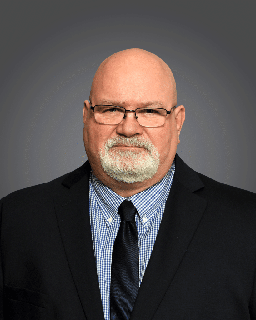

Richard Kennedy, RPLS
- Registered Professional Land Surveyor licensed in Texas since 2002 (License No. 5527), boasts an impressive 46-year career with 32 dedicated years at G&AI
- Has extensive experience working with title and commercial boundary surveys, construction surveys, large-diameter route surveys for water and sewer transmission lines, creating topographic surveys and right-of-way maps with easement preparation, airport topographic surveys, and TxDOT ROW and topographic mapping
- Has worked on an ongoing basis for more than 25 years with Trinity River Authority of Texas, 20 years with North Texas Municipal Water District, and 25 years with the City of Fort Worth, along with municipalities and water districts around the metroplex
Active member of:
- The Texas Society of Professional Surveyors (TSPS)
TxDOT PreCertified:
- 15.1.1 Right of Way Surveys
- 15.2.1 Design Survey
- 15.2.2 Construction Survey
- 15.3.5 Horizontal and Vertical Control
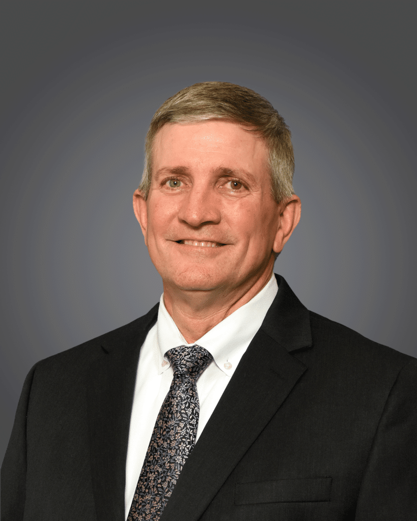

Curtis Smith, RPLS
- Registered Professional Land Surveyor licensed in Texas since 2001 (License No. 5494), boasts an impressive 37-year career with 25 dedicated years at G&AI
- Bachelor’s Degree in Science/Agricultural Economics from Tarleton State University
- Since 1998, he has been actively involved with TxDOT, the City of Fort Worth, and surrounding municipalities, gaining in-depth familiarity with their standards
- Has extensive experience working with title and commercial boundary surveys, construction surveys, large diameter route surveys for water and sewer transmission lines, creating topographic surveys and right-of-way maps with easement preparation, as well as airport topographic surveys and TxDOT ROW and topographic mapping
Active member of:
- The Texas Society of Professional Surveyors (TSPS)
TxDOT PreCertified:
- 15.1.1 Right of Way Surveys
- 15.2.1 Design Survey
- 15.2.2 Construction Survey
- 15.3.3 Terrestrial LiDAR
- 15.3.5 Horizontal and Vertical Control


Jon Cooper, RPLS
- Registered Professional Land Surveyor licensed in Texas since 1998 (License No. 5254), boasting an impressive 38-year career with 28 dedicated years at G&AI
- Mr. Cooper serves as the Project Manager and Safety Director
- Certified as an OSHA Authorized Construction Trainer from 2012 through 2020
- Has extensive experience working with title and commercial boundary surveys, construction surveys, large diameter route surveys for water and sewer transmission lines, creating topographic surveys and right-of-way maps with easement preparation, airport topographic surveys, and TxDOT ROW and topographic mapping
Active member of:
- Texas Society of Professional Surveyors (TSPS)
- National Society of Professional Surveyors (NSPS)
TxDOT PreCertified:
- 15.1.1 Right of Way Surveys
- 15.2.1 Design Surveys
- 15.2.2 Construction Surveys
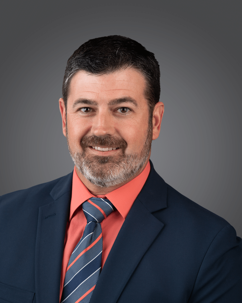

Josh Burge, PLS (OK) sUAS Pilot
- Professional Land Surveyor licensed in Oklahoma since 2011 (License No. 1762) and a Licensed Pilot since 2021, boasts an impressive 25-year career, with 14 dedicated years at G&AI
- Mr. Burge serves as the UAS Division Manager, Construction Division Manager, and Electrical Infrastructure Manager
- Has worked for multiple electric transmission providers in the State of Texas and Oklahoma, focusing on electric transmission and substation projects, TxDOT topographic design surveys, creek and river hydraulic surveys, construction layout for commercial development, and large-diameter water and sanitary sewer pipeline surveys
- Has extensive experience with multiple UAS systems:
- Alpha A900
- DJI M300
- Harris Aerial H6E
- Utilizing multiple LiDAR payloads (LiDAR Swiss, RockRobotic)
- Aerial mapping cameras (Zenmuse P1, the Phase 1 IXM100, the Infrared Zenmuse H20T)
Active member of:
- Texas Society of Professional Surveyors (TSPS)
- American Society for Photogrammetry and Remote Sensing (ASPRS)
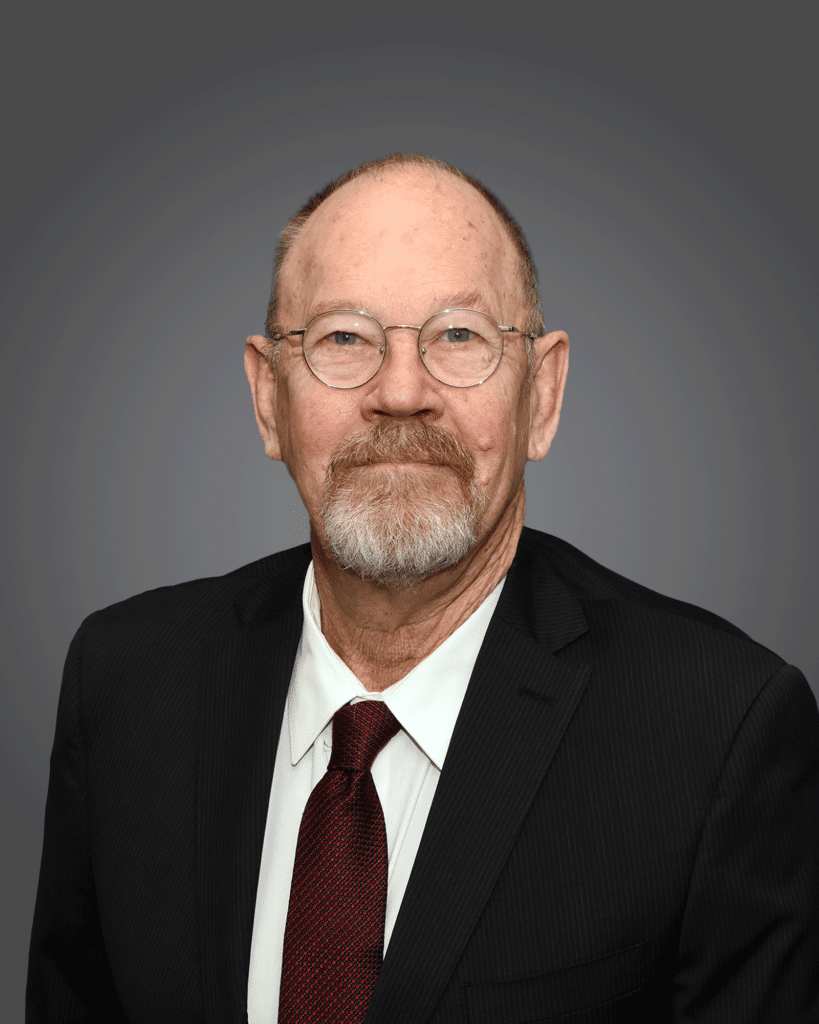

James “Matt” Ewing, RPLS
- Registered Professional Land Surveyor licensed in Texas since 1991 (License No. 4892), boasts an impressive 53-year career with 12 dedicated years at G&AI
- Has experience working with title and commercial boundary surveys, construction surveys, open ditch water transmission canals, large-diameter route surveys for water, flood control drainage ditches, and creating topographic surveys and right-of-way maps with easement preparation, airport topographic surveys, and TxDOT ROW and topographic mapping
- Since 1990, he has been actively involved with the City of Houston, Harris County, and surrounding municipalities, gaining in-depth familiarity with their standards
- Since 2012, Mr. Ewing has managed TxDOT survey projects in the Houston, Beaumont, Lufkin, and Yoakum Districts
Active member of:
- Texas Society of Professional Surveyors (TSPS)
- National Society of Professional Surveyors (NSPS)
- American Council of Engineering Companies of Texas (ACEC)
TxDOT PreCertified:
- 15.1.1 Right of Way Surveys
- 15.2.1 Design Surveys
- 15.2.2 Construction Surveys
- 15.3.5 Horizontal and Vertical Control


Kevin Marquez, RPLS
- Registered Professional Land Surveyor licensed in Texas since 2018 (License No. 6914), boasts an impressive 10-year career with seven dedicated years at G&AI
- Bachelor of Science in Civil Engineering from the University of Texas Rio Grande Valley
- Has successfully managed survey projects in the Houston area, which involved work for the Harris County Flood Control District, Harris County Engineering Department, Cedar Port Navigation and Improvement District, and the City of Houston. He has also been involved with projects related to the San Jacinto River Authority, Lavaca-Navidad River Authority, and San Antonio River Authority
- His expertise encompasses title and commercial boundary surveys in compliance with ALTA/NSPS standards, topographic design surveys with easement preparation for municipal water and wastewater infrastructure, traffic control signals, channel rehabilitation for flood control, railroad expansions, building expansions, as-built surveys for drainage systems and large-scale retail distribution centers
Active member of:
- Active Texas Society of Professional Surveyors (TSPS)
- Houston Hispanics of Architects and Engineers (HHAE) currently serves as a board member
TxDOT PreCertified:
- 15.1.1 Right of Way Surveys
- 15.2.1 Design Surveys
- 15.2.2 Construction Surveys
- 15.3.5 Horizontal and Vertical Control
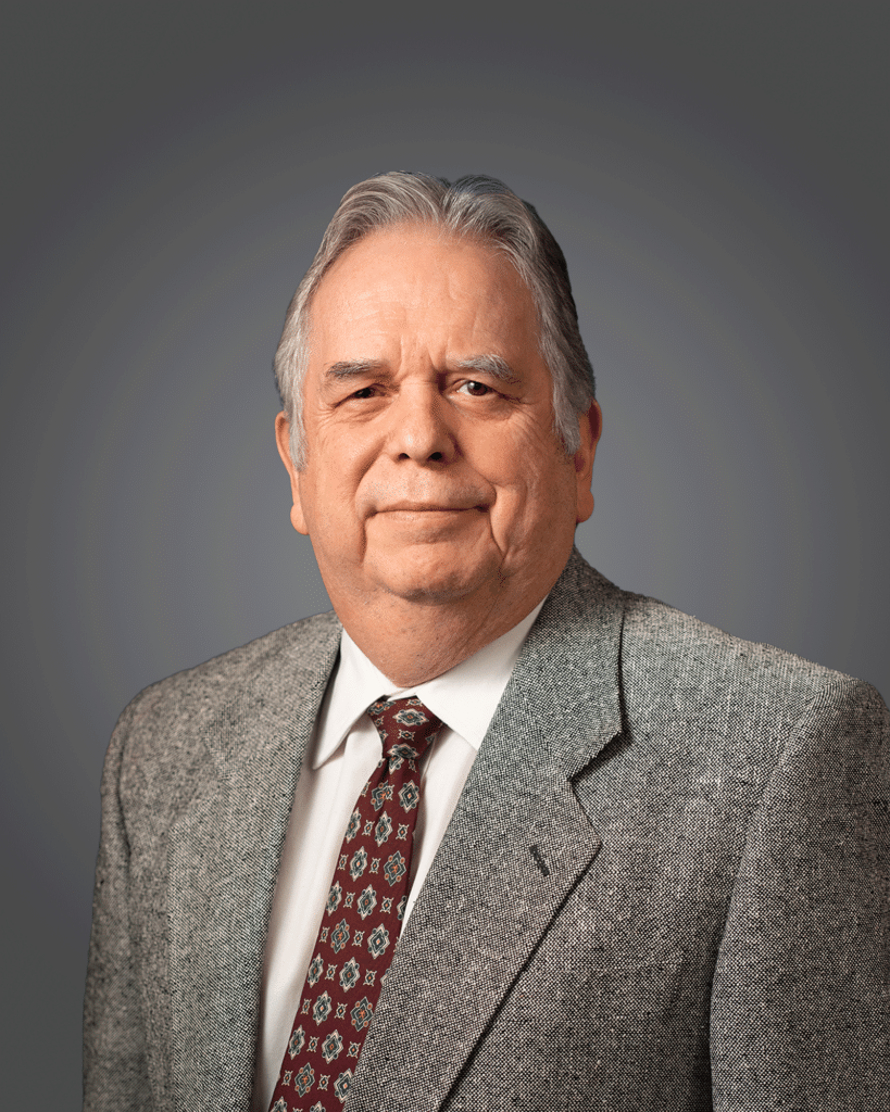

Paul Montez, CP
- ASPRS Certified Photogrammetrist since 2014 (No. 1571), boasts an impressive 35-year career with 11 dedicated years at G&AI
- Associate's Degree in Liberal Arts from San Antonio College
- Has extensive experience in all phases of photogrammetry, digital orthophotography, LiDAR, and Geographic Information Systems. He has worked on a wide range of projects, including drainage and flood study, municipal infrastructure, college campus facilities management, highway design, aerial flight planning, and mining
- Mr. Montez has successfully managed TxDOT aerial projects for several districts throughout the state. He has also managed many aerial projects for private engineering firms, municipal and county governments, the U.S. Navy, and the U.S Army Corps of Engineers throughout his career
Active member of:
- American Society for Photogrammetry and Remote Sensing (ASPRS)
TxDOT Pre-Certified:
- 15.3.1 Aerial Photogrammetry


Erica Carr
- Professional Photogrammetrist since 2001 and Mobile LiDAR Project Manager since 2022, boasts an impressive 25-year career with 12 dedicated years at G&AI
- Has extensive experience creating topographic mapping using Photogrammetry and LiDAR point clouds with seamless integration of Mobile data incorporated with Aerial, Drone, Terrestrial, and Field Survey maps. She is well versed with TxDOT ROW Mapping, Airport pavement topographic mapping, Rural roads, Multilane highways, City sidewalk ADA mapping, and Bridge Substructures for various Counties across Texas (Bexar, El Paso, Harris, Galveston, Midland, Refugio, Robertson, Titus, Tyler, Wichita)
- Oversees the planning and acquisition to feature extraction and final deliverables with G&AI’s Mobile LiDAR system (Leica Pegasus: Two). Involved with research, development, and operator training to maintain streamlined production workflows for Photogrammetry and LiDAR feature extraction while adopting new technology
Active member of:
- American Society for Photogrammetry and Remote Sensing (ASPRS)
TxDOT Pre-Certified:
- 15.3.1 Aerial Photogrammetry


Zack Doss, RPLS
- Registered Professional Land Surveyor in Texas since 2023 (License No. 7073), boasts an impressive 11-year career
- Bachelor of Science in Biology from Texas Tech University
- Has extensive experience working in title and commercial boundary surveys, topographic mapping for utility and roadway projects, platting, construction staking, easement preparation, ROW mapping, electrical transmission, and pipeline surveying
Active member of:
- Texas Society of Professional Surveyors (TSPS)
- American Council of Engineering Companies of Texas (ACEC)


Lee Gurecky, PE
• As a Geotechnical Engineering Project Manager, Mr. Gurecky is responsible for overseeing all aspects of GAI geotechnical engineering projects, ensuring schedule adherence, and managing the technical and engineering disciplines involved in the project
Active member of:
· Texas Council of Engineering Laboratories (TCEL)
TxDOT PreCertified:
Brad Gorrondona
President
Truett Wilson
Director of Survey
Scott Dunham
Geospatial Director
Chris Abbott
Senior Project Manager
Richard Kennedy
Senior Project Manager
Curtis Smith
Senior Project Manager
Jon Cooper
SeniorProject Manager
Josh Burge
Senior Project Manager
James "Matt" Ewing
Houston District Manager
Paul Montez
San Antonio District Manager
Kevin Marquez
Senior Project Manager
Erica Carr
Geospatial Project Manager
Employment
Interested in
being part of our team?
The Team
Meet the People
Karl Komatsu
President and CEO
Amy Sibley
Member
Andrea Kimes
Member
Anne McBurnett
Member
Aurdie Evans
Member
Charlie Kearns
Member
John Herr
Member
Les Edmonds
Member
Marie Oehlerking
Member
Nancy Kambalia
Member
Neil Bletsch
Member
Nicole Crowder
Member
Rick Sacy
Member
Ryan Brantley
Member
Stephanie Culver
Member
Vincent Ramirez
Member
Employment
Interested in
being part of our team?
Leadership Team
Meet the People
Brad Gorrondona, RPLS
President
Truett Wilson, RPLS
Director of Survey
Scott Dunham, CP
CMS- LiDAR – Director of Business Development
Employment
Interested in
being part of our team?
Unit. Whole.
Design/BuiId is a specialized team relationship. It is reflected through contractual agreement between the client/owner, architect/designer, and builder/contractor. This arrangement enhances services for all team members. The client/owner enjoys a single source for all design and construction services. Forming the team at the beginning of the project increases communication, provides immediate feedback on methods and budgets, reduces revisions and cost-overruns, and results in fewer schedule adjustments. In the fast-track method, design proceeds concurrently with construction, allowing the project to be completed more quickly. Design/Build combines the best of creative design and effective cost control by assuring the client that the work will be delivered on time and within budget.
get in touch
Submit a business inquiry
Our team is happy to answer your questions. Contact us and we’ll be in touch as soon as possible.

