TxDOT – US 59
About the Project
CLIENT
TxDOT Yoakum District
LOCATION
Wharton County, Texas
PROJECT TYPE
Aerial Mapping
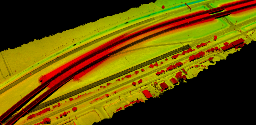
G&AI acquired data to support Digital Terrain Model (DTM) and planimetric feature extraction for the roadways. G&AI also extracted 3D breaklines (roadway surfaces) and 2D planimetric data from the LiDAR dataset and the simultaneously collected imagery. The LiDAR team delivered the classified point cloud data in .las format. Deliverables also include 2D and 3D MicroStation V8i file formats of planimetrics and DTM respectively, along with a GEOPAK .TIN file.
G&AI acquired data to support Digital Terrain Model (DTM) and planimetric feature extraction for the roadways. G&AI also extracted 3D breaklines (roadway surfaces) and 2D planimetric data from the LiDAR dataset and the simultaneously collected imagery. The LiDAR team delivered the classified point cloud data in .las format. Deliverables also include 2D and 3D MicroStation V8i file formats of planimetrics and DTM respectively, along with a GEOPAK .TIN file.
get in touch
We're Here to Help!
Our team is happy to answer your questions. Contact us and we’ll be in touch as soon as possible.