TxDOT - IH 10
About the Project
CLIENT
TxDOT Houston District
LOCATION
Colorado River to Brazos River, Colorado and Austin County, TX
PROJECT TYPE
LiDAR, Photogrammetric Mapping, and Professional Land Survey
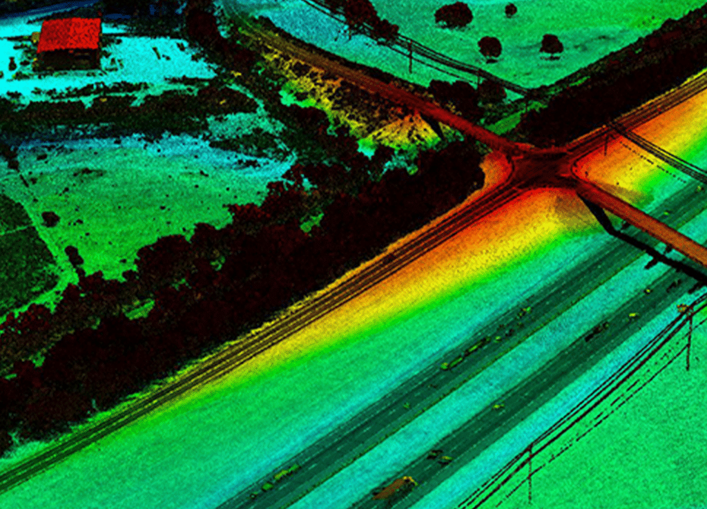
Project included professional survey and aerial mapping and LiDAR along IH 10, from the Colorado River to the Brazos River, in Colorado and Austin Counties. Helicopter LiDAR data was captured along the 31-mile transportation corridor at approximately 1000’ AGL. G&AI processed, classified, and performed DTM feature extraction from the LiDAR point cloud. In addition to LiDAR, G&AI also captured 5cm GSD (ground sampling distance) digital imagery to produce Ortho imagery and to collect 2D planimetric for the project. This project was delivered on time and exceeded accuracy specifications.
Project included professional survey and aerial mapping and LiDAR along IH 10, from the Colorado River to the Brazos River, in Colorado and Austin Counties. Helicopter LiDAR data was captured along the 31-mile transportation corridor at approximately 1000’ AGL. G&AI processed, classified, and performed DTM feature extraction from the LiDAR point cloud. In addition to LiDAR, G&AI also captured 5cm GSD (ground sampling distance) digital imagery to produce Ortho imagery and to collect 2D planimetric for the project. This project was delivered on time and exceeded accuracy specifications.
get in touch
We're Here to Help!
Our team is happy to answer your questions. Contact us and we’ll be in touch as soon as possible.