Sun Bowl Drive
About the Project
CLIENT
City of El Paso
LOCATION
El Paso, Texas
PROJECT TYPE
LiDAR, Professional Land Surveying, Terrestrial Laser Scanning
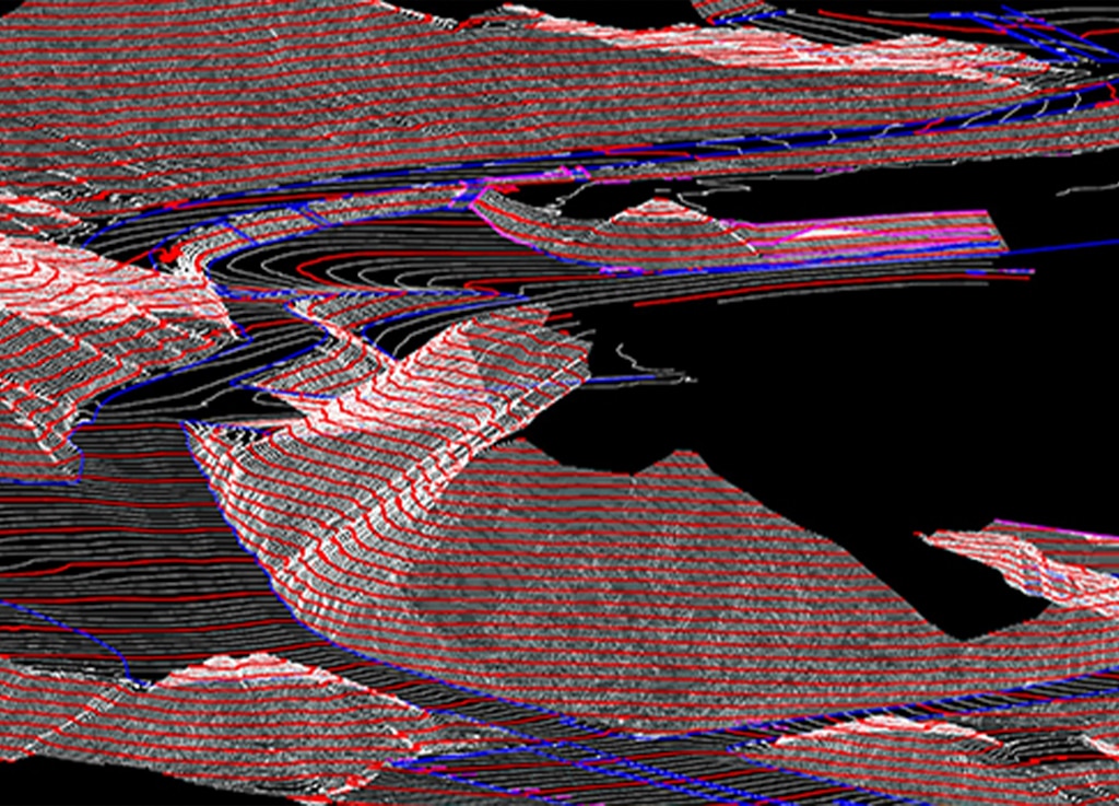
G&AI performed the terrestrial scanning of Sun bowl Drive in the City of El Paso as requested by TxDOT for the design of roadway improvements. Scanned topographic features from 200’ north of West University Avenue (at the traffic circle), to the entrance to Don Haskins Center. Also provided cross street topography on Glory Road from Sun Bowl Drive to 500 feet east on Glory Road and the entrance road into the Sun Bowl, going east to the parking lot near the stadium. Established three primary horizontal and vertical control monuments utilizing TxDOT’s Virtual Reference System (VRS) Network to establish the horizontal locations. The vertical component was established by digital electronic leveling runs using a control monument to verify the GPS elevations. Performed a complete 3D terrestrial LiDAR topographic survey of the entire length of the project with a point density of 30 points per square meter (PPMS) that included all surface features and utilities that are visible and apparent. Created break lines on all feature items of drainage and roadway shapes. Located all storm and sanitary sewer manholes, inlets or culverts discovered within the project limits and obtained invert elevations to the flow lines, plus size and direction of any pipes. Tied existing right-of-way points along the corridor; recovering property corners adjacent to Sun Bowl Drive. Contacted the City of El Paso and obtained the City’s right-of-way map. The accuracy on the rebuilt right-of-way map was plus or minus 0.50 feet for design level.
G&AI performed the terrestrial scanning of Sun bowl Drive in the City of El Paso as requested by TxDOT for the design of roadway improvements. Scanned topographic features from 200’ north of West University Avenue (at the traffic circle), to the entrance to Don Haskins Center. Also provided cross street topography on Glory Road from Sun Bowl Drive to 500 feet east on Glory Road and the entrance road into the Sun Bowl, going east to the parking lot near the stadium. Established three primary horizontal and vertical control monuments utilizing TxDOT’s Virtual Reference System (VRS) Network to establish the horizontal locations. The vertical component was established by digital electronic leveling runs using a control monument to verify the GPS elevations. Performed a complete 3D terrestrial LiDAR topographic survey of the entire length of the project with a point density of 30 points per square meter (PPMS) that included all surface features and utilities that are visible and apparent. Created break lines on all feature items of drainage and roadway shapes. Located all storm and sanitary sewer manholes, inlets or culverts discovered within the project limits and obtained invert elevations to the flow lines, plus size and direction of any pipes. Tied existing right-of-way points along the corridor; recovering property corners adjacent to Sun Bowl Drive. Contacted the City of El Paso and obtained the City’s right-of-way map. The accuracy on the rebuilt right-of-way map was plus or minus 0.50 feet for design level.
Our team is happy to answer your questions. Contact us and we’ll be in touch as soon as possible.