Red Oak Creek Interceptor, Relief Segment RO-3
About the Project
CLIENT
Trinity River Authority of Texas
LOCATION
Ovilla, Ellis County, Texas
PROJECT TYPE
Design Survey, GPS and Geodetic Control Survey, Off Right-Of-Way Access Easement, Land Surveying, Topographic Survey
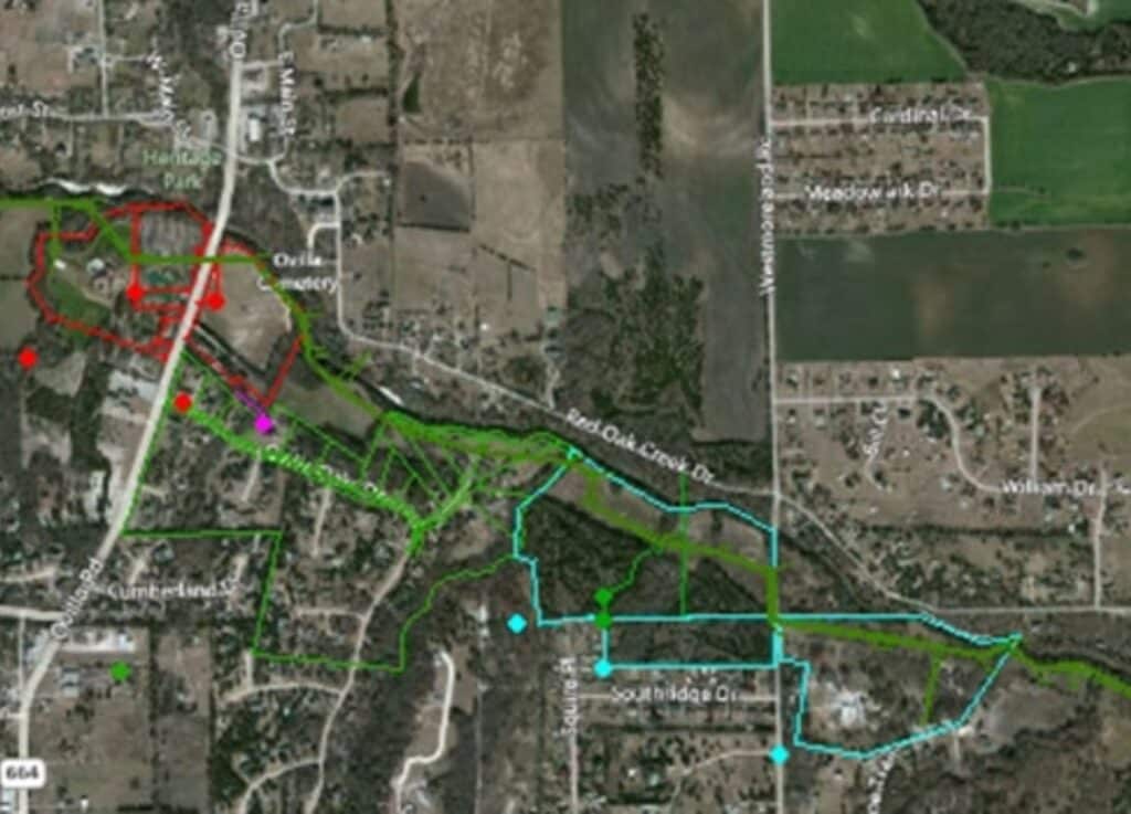
G&AI was subcontracted to perform a topographic/design survey of approximately 7,300 linear feet of an existing sanitary sewer line for the purpose of the construction of a new sanitary sewer line adjacent to the existing line. G&AI provided ownership research through Ellis County Appraisal District for approximately 15 parcels of land and prepared permit-to-survey letters and obtained permission from the owners of each affected property to perform necessary surveys. G&AI establish horizontal and vertical control for the project, and prepared a planimetric detail based on the ground survey showing existing visible elements within 30 feet (minimum) of either side of the existing 30-foot utility easement including, but not limited to the following: (existing pavement, curbs, sidewalks, barrier free ramps, lane striping, driveways, Existing storm sewer inlets, manholes, junction boxes, outfalls, erosion control, culverts, bridges, railroads, guardrail, utility manholes, vaults, water valves, water meters, sprinkler heads, telephone poles, power poles, utility markers, other public utilities, utilities, traffic signal poles, cabinets, other signal equipment, signs (excluding temporary signs), trees, buildings, retaining walls, fence limits and material types, flowlines of creeks, flowlines of manholes, inlets, culverts and other utility structures, property corners, field sketches of manholes and meter stations, and other applicable physical features that could impact design.
G&AI was subcontracted to perform a topographic/design survey of approximately 7,300 linear feet of an existing sanitary sewer line for the purpose of the construction of a new sanitary sewer line adjacent to the existing line. G&AI provided ownership research through Ellis County Appraisal District for approximately 15 parcels of land and prepared permit-to-survey letters and obtained permission from the owners of each affected property to perform necessary surveys. G&AI establish horizontal and vertical control for the project, and prepared a planimetric detail based on the ground survey showing existing visible elements within 30 feet (minimum) of either side of the existing 30-foot utility easement including, but not limited to the following: (existing pavement, curbs, sidewalks, barrier free ramps, lane striping, driveways, Existing storm sewer inlets, manholes, junction boxes, outfalls, erosion control, culverts, bridges, railroads, guardrail, utility manholes, vaults, water valves, water meters, sprinkler heads, telephone poles, power poles, utility markers, other public utilities, utilities, traffic signal poles, cabinets, other signal equipment, signs (excluding temporary signs), trees, buildings, retaining walls, fence limits and material types, flowlines of creeks, flowlines of manholes, inlets, culverts and other utility structures, property corners, field sketches of manholes and meter stations, and other applicable physical features that could impact design.
Our team is happy to answer your questions. Contact us and we’ll be in touch as soon as possible.