Gross Road Bridge Project
About the Project
CLIENT
TxDOT North Region
LOCATION
US 80 Dallas, Texas
PROJECT TYPE
LiDAR, Photogrammetric Mapping, Terrestrial Laser Scanning
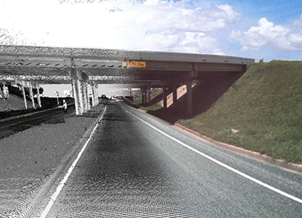
This was a LiDAR mapping project on 2-miles of US 80 centered on the Gross Road overpass. Established three Type II primary control points based on TxDOT’s Virtual Reference System (VRS), and set 11 secondary control points. Acquired aerial LiDAR mapping using a Riegal full waveform laser scanner with an approximate acquisition density of 40 points per square meter. Collected break lines for roadway centerline, edge of pavement, ditchlines, and turnouts. Extracted 1’ contours from DTM and merged break lines with LiDAR digital elevation model (DEM) to create final DTM. Located and measured flowlines on drainage features consisting of drop inlets, curb inlets, and reinforced concrete pipes under the ramps. Acquired terrestrial laser scanning of the substructure of the Gross Road overpass detailing columns, bents, beams and abutments.
This was a LiDAR mapping project on 2-miles of US 80 centered on the Gross Road overpass. Established three Type II primary control points based on TxDOT’s Virtual Reference System (VRS), and set 11 secondary control points. Acquired aerial LiDAR mapping using a Riegal full waveform laser scanner with an approximate acquisition density of 40 points per square meter. Collected break lines for roadway centerline, edge of pavement, ditchlines, and turnouts. Extracted 1’ contours from DTM and merged break lines with LiDAR digital elevation model (DEM) to create final DTM. Located and measured flowlines on drainage features consisting of drop inlets, curb inlets, and reinforced concrete pipes under the ramps. Acquired terrestrial laser scanning of the substructure of the Gross Road overpass detailing columns, bents, beams and abutments.
Our team is happy to answer your questions. Contact us and we’ll be in touch as soon as possible.