Tulsa Asset Inventory
About the Project
CLIENT
City of Tulsa
LOCATION
Tulsa, Oklahoma
PROJECT TYPE
Mobile LIDAR, GIS
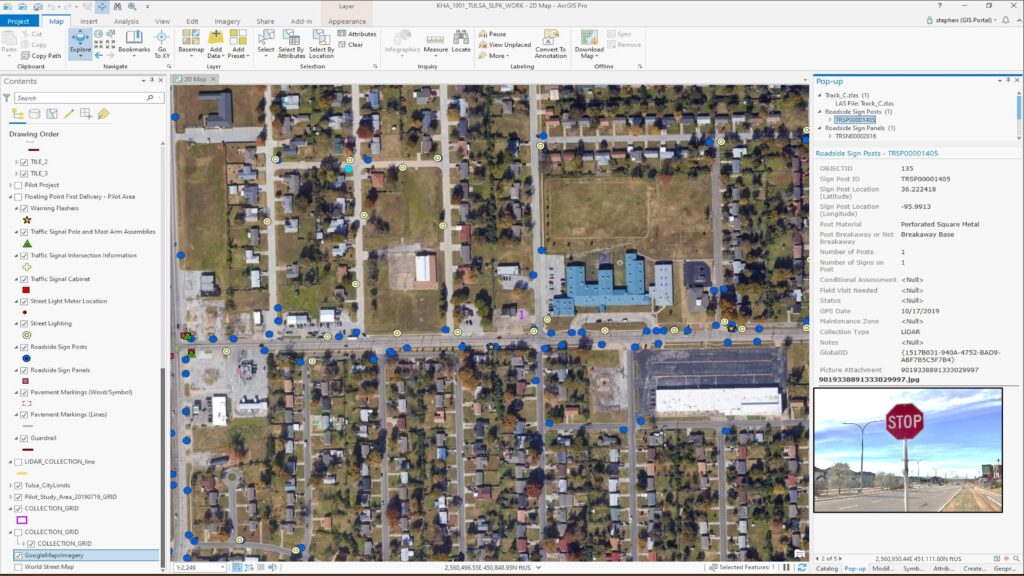
G&AI acquired and processed 2,064 linear miles for an asset inventory within the City of Tulsa, OK city limits. The processed and classified point cloud and simultaneously collected 360° high-definition imagery were used to performed feature extraction of city assets including, streetlights, guardrails, MUTCD signs, traffic signals, traffic signal cabinets, and school zone flashers. All assets were collected and placed in a 3D ESRI geodatabase.
G&AI acquired and processed 2,064 linear miles for an asset inventory within the City of Tulsa, OK city limits. The processed and classified point cloud and simultaneously collected 360° high-definition imagery were used to performed feature extraction of city assets including, streetlights, guardrails, MUTCD signs, traffic signals, traffic signal cabinets, and school zone flashers. All assets were collected and placed in a 3D ESRI geodatabase.
G&AI acquired and processed 2,064 linear miles for an asset inventory within the City of Tulsa, OK city limits. The processed and classified point cloud and simultaneously collected 360° high-definition imagery were used to performed feature extraction of city assets including, streetlights, guardrails, MUTCD signs, traffic signals, traffic signal cabinets, and school zone flashers. All assets were collected and placed in a 3D ESRI geodatabase.
Our team is happy to answer your questions. Contact us and we’ll be in touch as soon as possible.