CEDAR PORT TRACT 2 – 1.2M SF WAREHOUSE SITE
About the Project
CLIENT
TGS/ Cedar Port Partners
LOCATION
Chambers County, Texas
PROJECT TYPE
ALTA/NSPS Land Title, Professional Land Survey
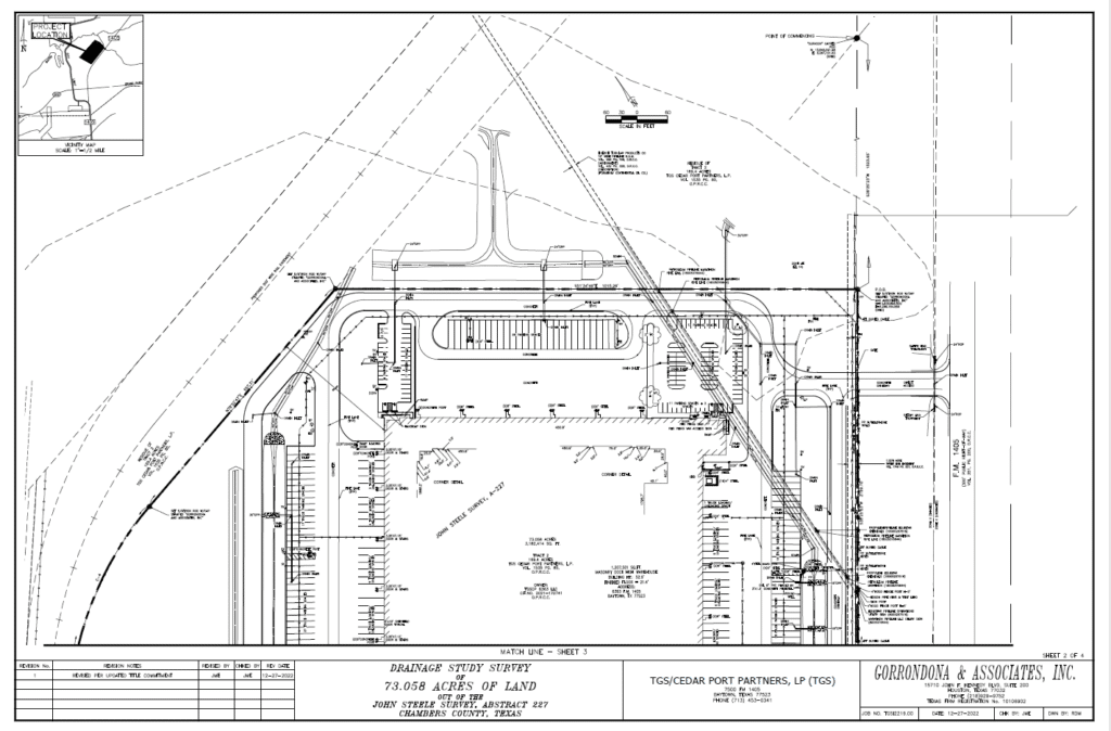
G&AI completed an updated ALTA/NSPS Land Title Survey. Our team accurately mapped the property’s boundaries and dimensions, using precise courses and distances. A key aspect of our survey was identifying and measuring any potential encroachments. This included any overhangs by the property’s structures onto neighboring lands, streets, alleys, or easements, as well as encroachments from adjacent properties onto the surveyed land. We used U.S. Survey Feet for all measurements to ensure high accuracy. G&AI diligently searched for and documented any visible discrepancies or potential conflicts, including area shortages or boundary line disputes, in comparison to the title commitment. Additionally, we provided detailed information on the location, rim, and flowline elevations of existing storm and sanitary sewer facilities on the property to offer a comprehensive overview of the drainage infrastructure. Our team also undertook a thorough analysis comparing the provided plan sets with the data we collected. G&AI also provided a separate, detailed metes and bounds description which was proofread and verified for accuracy by two Registered Professional Land Surveyors, ensuring the highest standard of precision and reliability in our survey results.
G&AI completed an updated ALTA/NSPS Land Title Survey. Our team accurately mapped the property’s boundaries and dimensions, using precise courses and distances. A key aspect of our survey was identifying and measuring any potential encroachments. This included any overhangs by the property’s structures onto neighboring lands, streets, alleys, or easements, as well as encroachments from adjacent properties onto the surveyed land. We used U.S. Survey Feet for all measurements to ensure high accuracy. G&AI diligently searched for and documented any visible discrepancies or potential conflicts, including area shortages or boundary line disputes, in comparison to the title commitment. Additionally, we provided detailed information on the location, rim, and flowline elevations of existing storm and sanitary sewer facilities on the property to offer a comprehensive overview of the drainage infrastructure. Our team also undertook a thorough analysis comparing the provided plan sets with the data we collected. G&AI also provided a separate, detailed metes and bounds description which was proofread and verified for accuracy by two Registered Professional Land Surveyors, ensuring the highest standard of precision and reliability in our survey results.
Our team is happy to answer your questions. Contact us and we’ll be in touch as soon as possible.