Cedar Port Cal Cartage (11.568 Acres)
About the Project
CLIENT
Berryman Chemical Inc
LOCATION
Chambers County, Texas
PROJECT TYPE
Professional Land Survey, Topographic and Boundary Survey
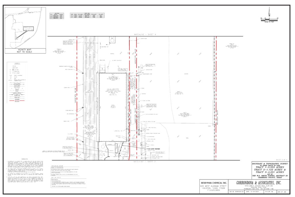
G&AI has completed an updated ALTA/NSPS Land Title Survey with precision and expertise. G&AI accurately delineated the property’s layout, using detailed measurements of courses and distances. The comprehensive survey included pinpointing the location and size of any encroachments. This involved assessing whether improvements on the property extended onto adjacent lands, streets, alleys, or easements, as well as noting any potential encroachments from neighboring properties onto the surveyed tract. These encroachments, whether on the property itself or affecting any related easement, were measured in U.S. Survey Feet for utmost accuracy. In addition, G&AI carefully examined and reported any visible discrepancies or conflicts, such as differences in area or inconsistencies with boundary lines, in comparison to the title commitment. We also identified and mapped out the building setback lines as specified in the title commitment. G&AI also provided a separate, detailed metes and bounds description which was proofread and verified for accuracy by two Registered Professional Land Surveyors, ensuring the highest standard of precision and reliability in our survey results.
G&AI has completed an updated ALTA/NSPS Land Title Survey with precision and expertise. G&AI accurately delineated the property’s layout, using detailed measurements of courses and distances. The comprehensive survey included pinpointing the location and size of any encroachments. This involved assessing whether improvements on the property extended onto adjacent lands, streets, alleys, or easements, as well as noting any potential encroachments from neighboring properties onto the surveyed tract. These encroachments, whether on the property itself or affecting any related easement, were measured in U.S. Survey Feet for utmost accuracy. In addition, G&AI carefully examined and reported any visible discrepancies or conflicts, such as differences in area or inconsistencies with boundary lines, in comparison to the title commitment. We also identified and mapped out the building setback lines as specified in the title commitment. G&AI also provided a separate, detailed metes and bounds description which was proofread and verified for accuracy by two Registered Professional Land Surveyors, ensuring the highest standard of precision and reliability in our survey results.
Our team is happy to answer your questions. Contact us and we’ll be in touch as soon as possible.