Stryker Creek 138kV Switchyard
About the Project
CLIENT
Stryker Generation Plant
LOCATION
New Summerfield, Texas
PROJECT TYPE
Professional Land Survey, Terrestrial Laser Scanning
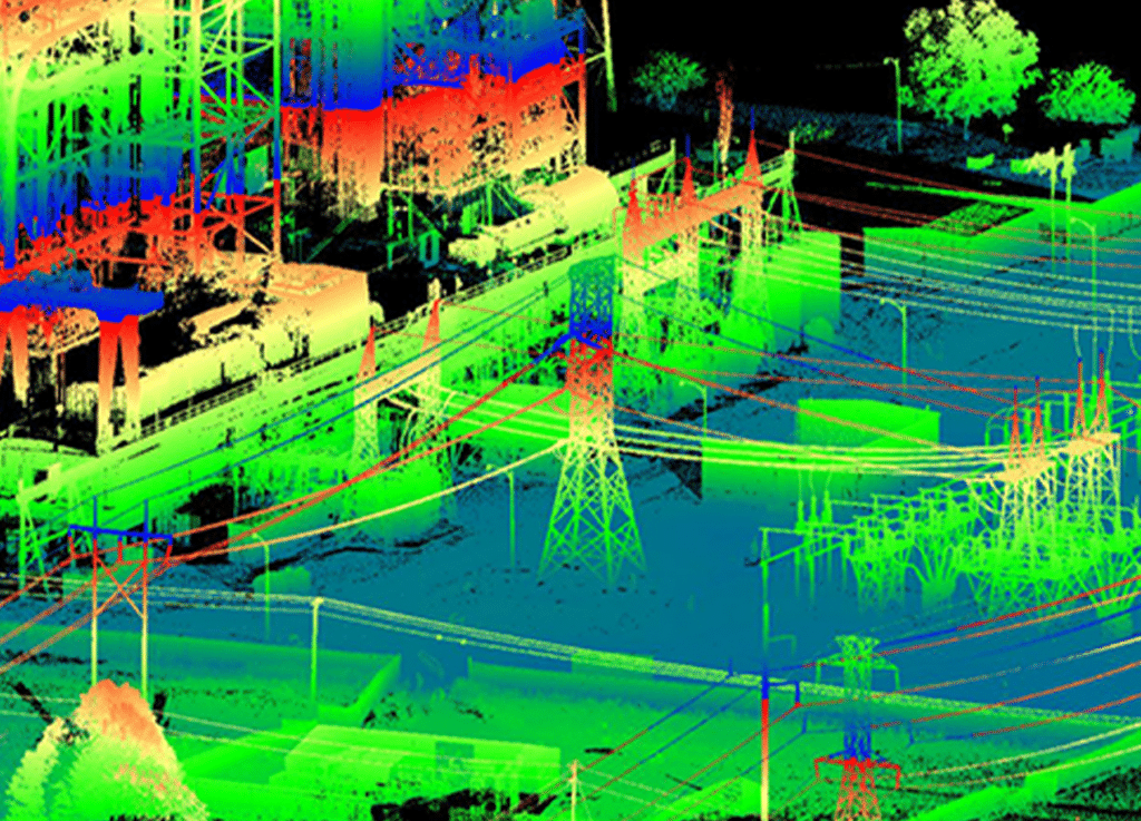
G&AI provided terrestrial laser scanning services for the Stryker Generation Plant 138kV switchyard and 1.1-mile of 138kV pole replacements adjacent to the switch. The 138kV switchyard had developed ponding areas throughout the years; terrestrial laser scanning was utilized to determine the exact locations of the areas that were prone to ponding, as conventional ground surveying on a grid type basis did not determine those areas. All foundations within the switchyard were modeled along with the HIGH BUS and LOW BUS along with a 25’ grid and identification of the areas that were prone to ponding. Since the scanner was mobilized, the client also requested modeling for seven 138kV transmission poles within a 100-foot corridor (50’ right and 50’ left of the existing centerline) for a future rebuild. All attachment points, 10 points along the conductor wire sag, and shield wires were modeled along with a report of the time and temperature of the scans. The deliverables included a tin model, of the switchyard and 100 foot wide corridor with grade breaks and planimetric data identified, a PLS listing of all points identified and an AutoCAD drawing of the contours, planimetrics and tin model.
G&AI acquired and processed 2,064 linear miles for an asset inventory within the City of Tulsa, OK city limits. The processed and classified point cloud and simultaneously collected 360° high-definition imagery were used to performed feature extraction of city assets including, streetlights, guardrails, MUTCD signs, traffic signals, traffic signal cabinets, and school zone flashers. All assets were collected and placed in a 3D ESRI geodatabase.
G&AI acquired and processed 2,064 linear miles for an asset inventory within the City of Tulsa, OK city limits. The processed and classified point cloud and simultaneously collected 360° high-definition imagery were used to performed feature extraction of city assets including, streetlights, guardrails, MUTCD signs, traffic signals, traffic signal cabinets, and school zone flashers. All assets were collected and placed in a 3D ESRI geodatabase.
get in touch
We're Here to Help!
Our team is happy to answer your questions. Contact us and we’ll be in touch as soon as possible.